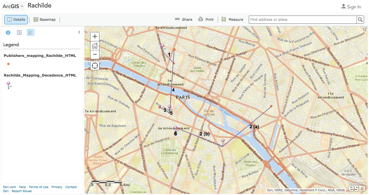
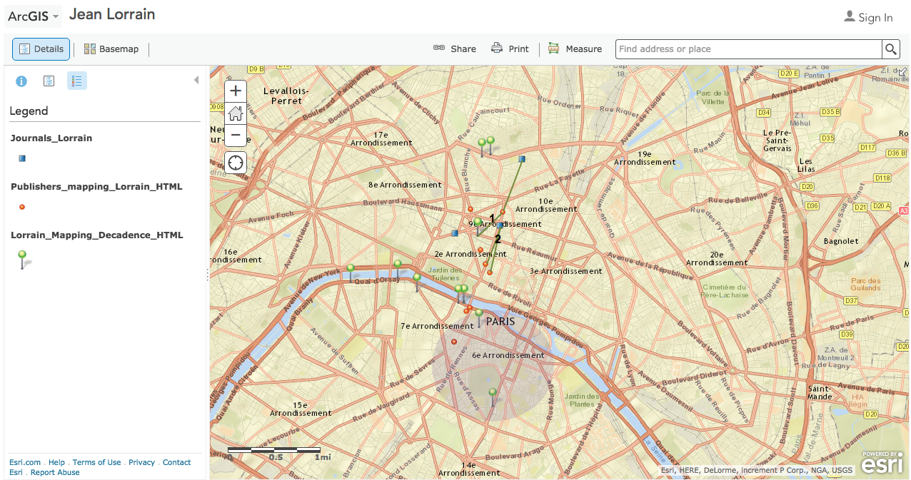
I chose to examine the Mapping Decadence project for this week’s blog post. It visualizes the relationship between Decadent writers and their publishers at the end of the nineteenth century in Paris by showing how location played a role in their collaborations. There are five maps that were created by ArcGIS, and four of them focus on the authors: Jean Lorrain, Joris-Karl Huysmans, Marcel Schwob, and Rachilde. The fifth map is a collection of all the four maps. Each page has an image that can link you to the interactive map, or you can click on the link underneath the image that gives access to the map. The map shows pins with specific colors representing different authors and the red pin representing publishers. It also shows lines connecting the authors to publishers. An info box pops up once you click on a pin or a line that gives information about the residence, time of residence, published books and with whom, where they were living or working at the time, and the location of their publishers.
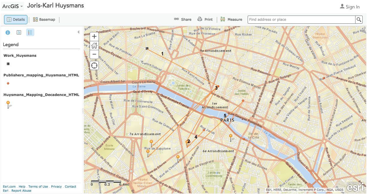
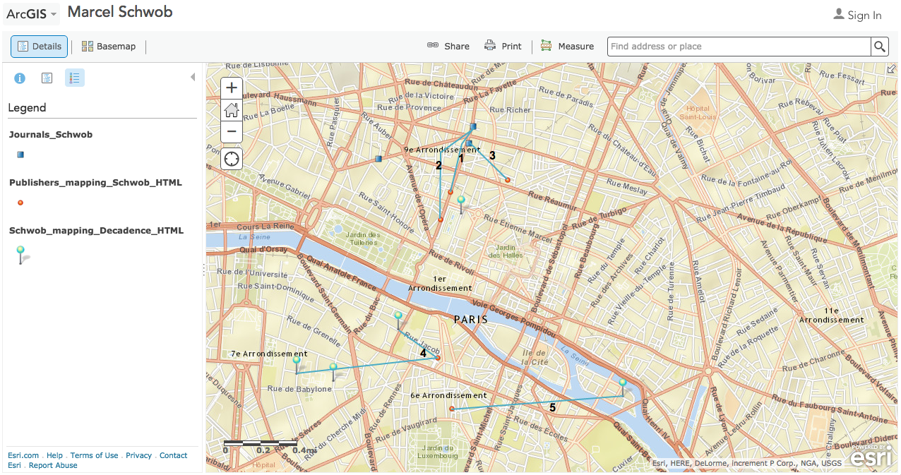
Joris-Karl Huysmans and Marcel Schwob seem to have mostly collaborated with publishers living within their vicinity since most of the pins and the connections are clustered together depending on where the authors were located. Perhaps they wanted to work with publishers as closely and frequently as possible, since they chose to work with publishers near their area.
Rachilde worked with publishers both near and far, which shows that distance wasn’t much of an issue for him when working with a publisher.
Jean Lorrain’s map is a bit out of the ordinary compared to the other writers. While their maps show several lines connecting the authors to their publishers, Jean Lorrain has very few connections with the publishers. On the map, there are 8 publishers he worked with, but Jean Lorrain’s pins can be found all over Paris. He seems to have liked working in many different places. Interestingly, many of these places are at hotels near the Seine River. Also, the map shows that Jean Lorrain was often in the Quartier Latin indicated by the shaded circle where he collaborated with several publishers living in or nearby the Quartier Latin.
The map assumes that the user is familiar with the Decadent writers and their works since it doesn’t give much information about the authors themselves. It gives interesting information to those who might want to know more about the relationship between writers and publishers back in the nineteenth century. Other than that, little is known about the writers, their works, and the publishers. And this makes it hard to understand the significance of this mapping project. Why was it important or interesting to know how these writers collaborated with different publishers based on their location? If there was an information box next to the map that gave a brief introduction or summary about who the writer was or the publisher was, this site would be more helpful and engaging to users who do not know much about Parisian writers during this time.