For this week’s blog post, I decided to analyze the mapping project of Locating London’s Past. Out of all of the maps from this week’s choices, this map stood out to me because through the map, there was a sense of a unity in time. The map demonstrates the geographical and industrialization changes over time, but also sharing London’s culture throughout.
The kind of assumptions that this map tries to show is how certain key areas of London have structurally changed throughout time. The map is divided into three main maps showing London in the year 1746 and the timeframe from 1869 to 1880, and the current map of today in 2015.
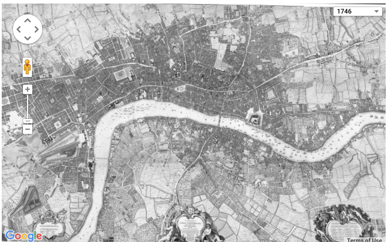
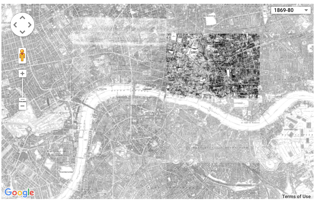
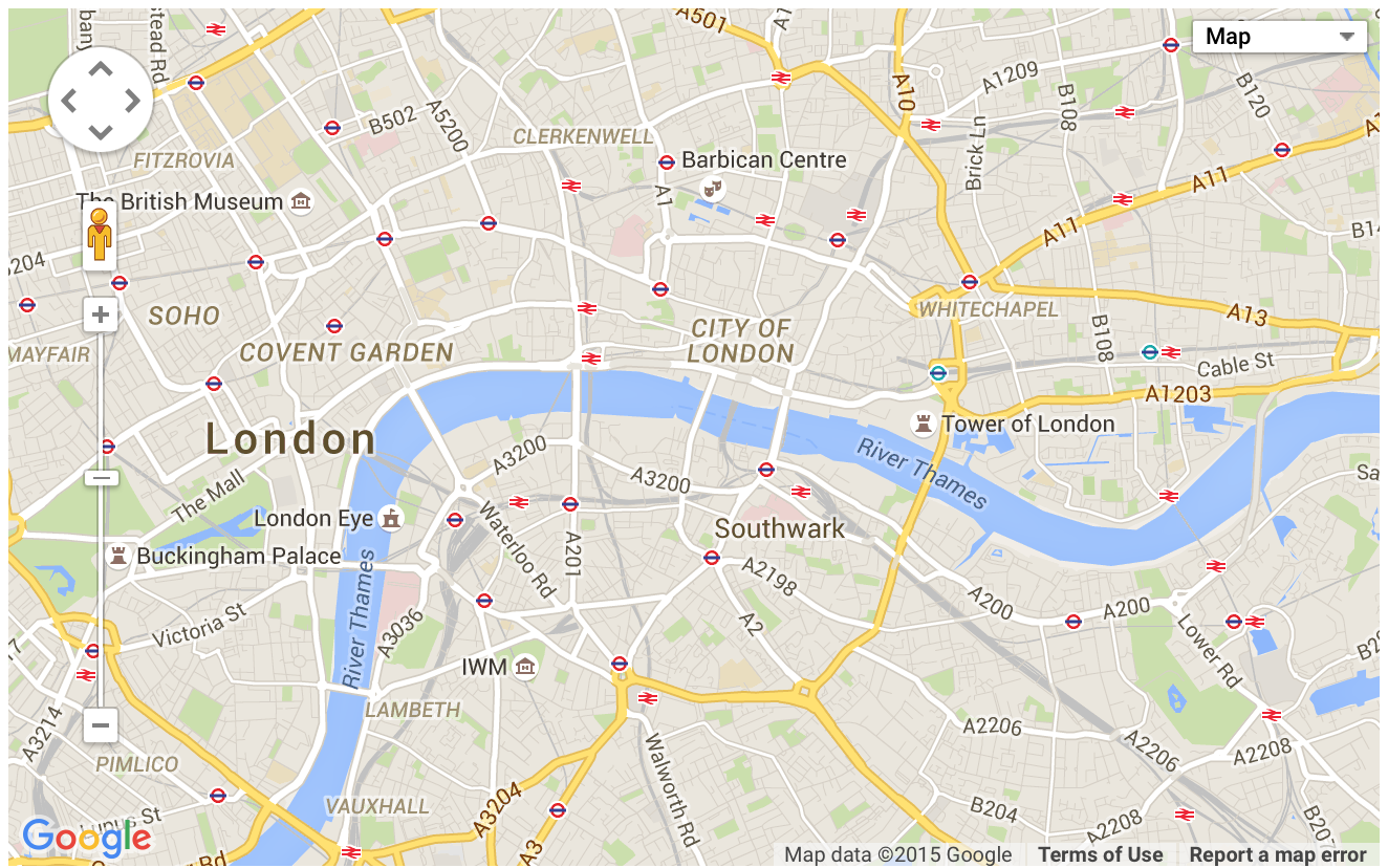
The assumptions that are made through the changes that are visualized in the maps are that these cities went from being a very simple town, to a civilized industrial city. We see that there are clearly more division among the towns and there are now more sites of entertainment. This specific map shows these changes, but there is a specific map option that is simply blank. I wasn’t sure what the purpose of this was in regards to comparing with the other layered maps. There are other smaller image maps that specifically foretell the historical occurrences of the Ordnance Survey, 1st edition map of London 1863-80 (1:2500) and John Rocque’s Survey of London, Westminster & Southwark, 1746. These maps were very parallel to the historical context provided by the event description page.
An alternative map to the main map would have the same time frames, but with specific individual’s names or images embedded to the map itself. In other words, I think it would have been very eye appealing to have made this changing map into an interactive map. This would have been more appealing because we can give a face to the event and time. It would have also been a more effective map if we had the opportunity to view the map as a full screen. Because this is such a unique map in which it shows the overall landscape of how London was geographically different throughout time, it would have been nice to see a bigger landscape in one viewing. I would have also definitely removed the blank map layer.
-Karla Contreras