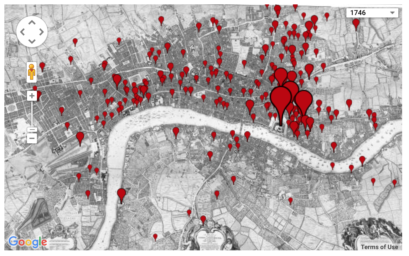
Locating London’s Past is an interactive map that uses the interface of a 1746 map, and then allows users to search through historical data sets and layer any data points they would like to see geolocated on the map. They pull from records of crime, poor relief, taxation, elections, local administration, plague deaths, and archaeological finds, some of which are from London Lives, the digital humanities project we analyzed earlier in the quarter. Being able to locate these records of events on a historical map helps make connections to the way London is today.
The map seems to make the assumption that the user is already very familiar with and understands the source data set, because there is no easy way to access the record or even a brief summary of the record directly from the mapping site, rather, you have to go directly to the data set itself and find it. For those who don’t know as much about the records themselves, the map still is pretty effective at communicating general ideas of the historical geography of London. It allows you to quickly map the locations of an entire data set, and uses location markers of varying sizes to indicate how many records had that location. I found this very helpful and interesting when mapping the poor relief records, which enabled me to easily identify the socioeconomic statuses of each area of London. However, once again, when the map compiles all the records into simple red markers, it obscures a lot of the important details of the data.
The base map itself is a fantastic resource to build off of, but it has so many tiny details that it can be difficult to read and navigate. If I were to make an alternative map, I would use the same John Rocque 18th century map, but I would digitize and make it more interactive it so its more easily readable, so when you are zoomed out you can still see the major, important labels of the city, and then when you zoom the more detailed information is readable. Additionally, I would add a feature that makes it easier to access the actual information in a record without having to sift through the data set. I would do this using a pop-up window that featured key words and a short summary of the record, along with the link directly to the original data. These changes would make the map a better source about London’s past beyond just the geographical data.