The reVilna project: “Exploring the Vilnius Ghetto: A Digital Monument” showcased the lives of Jews in the Vilna Ghetto from its emerging to its liquidation by mapping different events and stories out using information from memoirs, archives and historical accounts.
The careful combination of maps, timelines, stories and pictures provided the readers with visual insight of how the Jews lived in the Ghettos. Because the project is coming from the point of view of the victims of the holocaust, it creates a rather intimate connection with the viewers. It is almost as if the viewers are walking down the road to the Ghetto along with these victims, fighting not to be taken away and finally settling down in this environment. At some point, the Ghetto almost turns into a functional city with a medical center, prison, restaurant, sport field, etc. It is very interesting to visualize these facilities scattered around the their area because it truly resembles a modern city that you can look up on Yelp.
What is obscured in this project is the perspective of the aggressors, which is not necessarily a bad thing. I believe the creators of the project intentionally did so because knowing too much about the German or Lithuanian perspective would distract the viewers from immersing in the experience.
An interesting thing to note is that the map used in this project seems to be based on the current Google Map.
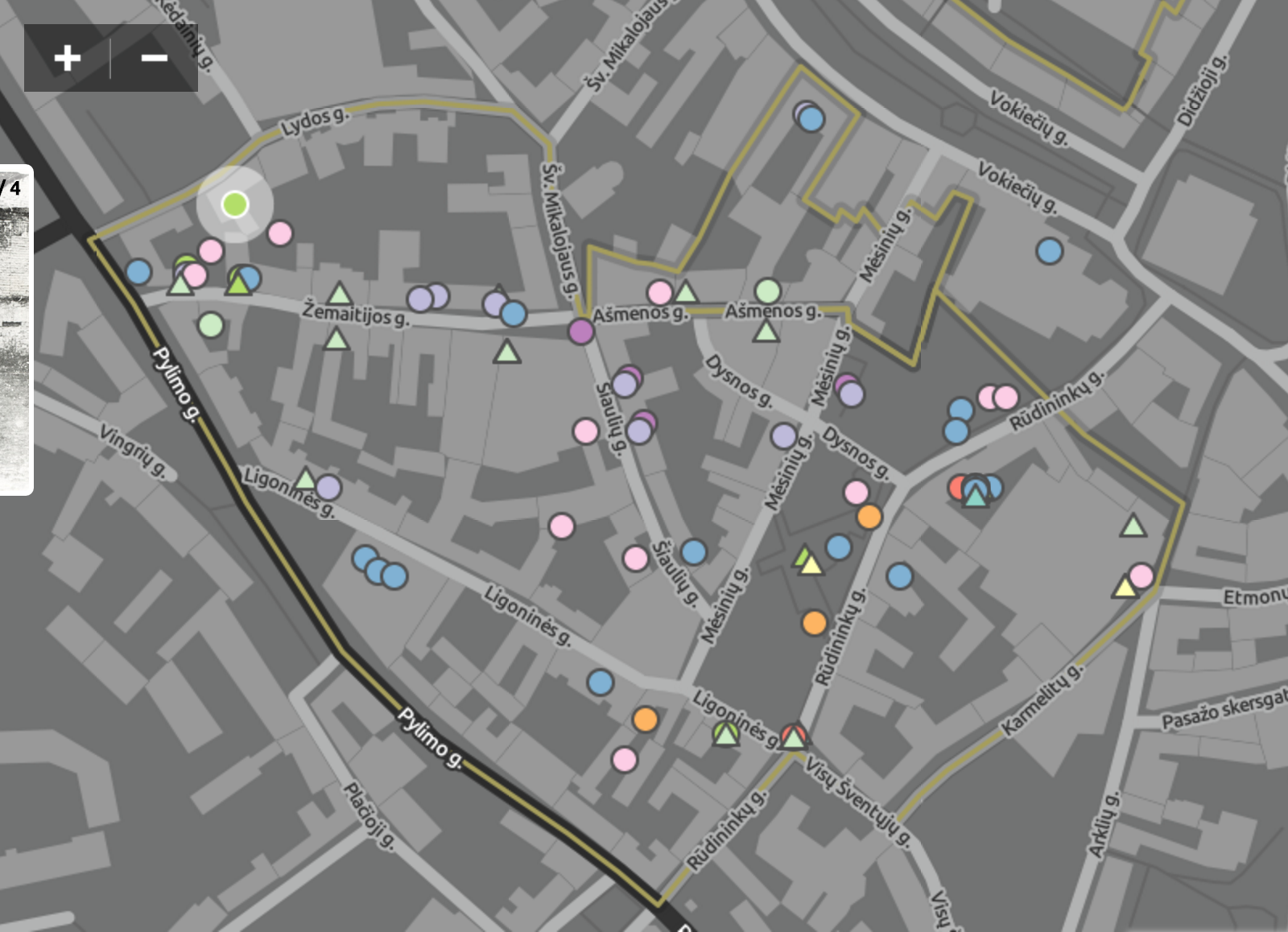
 In doing so, the creators made the assumption that the map remained the same since the Ghetto period. Therefore, the precision of the data points they plotted may not be as accurate and the events are not in their proper contexts.
Another thing to note is that the map does not zoom out beyond Vilnius. An ordinary reader who is not very familiar with details of European history and geography will not be able locate Vilnius on the European map. In fact, the average reader might not have even heard of Vilnius the city and its ties to the holocaust. Therefore, the project creators assumed that the readers had background knowledge on the Ghettos of Vilnius. This is not surprising as the project description on the homepage stated that the mapping project is “dedicated to understanding how the residents of the Ghetto lived, how the ghetto functioned — even, given the circumstances, flourished — how it emerged, and how, ultimately, it was liquidated. Using geographical science and technology, reVilna seeks to reimagine the Vilna Ghetto.” Instead of educating the general public about the existence and conditions of the Ghettos, this project is trying to help researchers of these Ghettos to visualize and re-evaluate the conditions.
If I had the choice, I might I might have preferred to give readers a little more backstory about the Ghettos. Also, I would be very interesting to add an option to switch from the current map to the map of Vilnius during the Ghetto period that we can either find or reconstruct using memoirs, archives and historical accounts. This way, viewers can not only see the events in their accurate context, but also see a comparison between the layouts of the city back then and that of today.
All in all, reVilna is a very informative project and does a very good job of giving its viewers a whole new level of understanding of the Vilna Ghetto experience.