For this week’s mapping exploration, I chose to look at Locating London’s Past, mainly because I do not consider myself well-versed in London’s extensive history and I thought it would be indicative of Turnbull’s arguments to see how this map would be received from someone who has little/no contextual knowledge of the subject.
Locating London’s Past was created by a team of different UK-based universities and offers a virtual exploration of life in “early modern and eighteenth century London” through a variety of different digital databases with records of crime, poor relief, taxation, elections, local administration, plague deaths and archaeological finds sourced from resources from the Old Bailey Online, London Lives, and the Centre for Metropolitan History. In turn, the different data sets are able to be
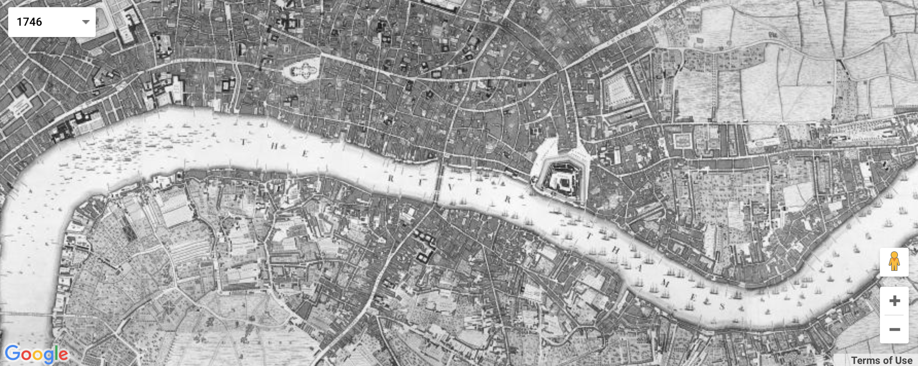
mapped on three different maps—a GIS compliant version of John Rocque’s 1746 map of London, the first accurate OS map of London (1869-80), and a current Google Maps version.

The project does not claim to offer an exhaustive account of London’s history nor to showcase a particular demographic, but rather leaves data exploration and narrative construction up to the user because truthfully, little guidance is given on what to do. That being said, this mapping project is still largely

an operating example of Turnbull’s contention that all maps are perspectival and subjective because “what is on the map is determined not simply by what is in the environment but also by the human agent(s) that produced it” (Exhibit 2, Page 1). For example, the contributors to Locating London’s Past chose to only include data from legalized sources and the data is limited for it only includes records for crime, taxation, elections, etc. Moreover, the project cites information about each data set on the Historical Background page. For the Old Bailey Proceedings Online data set, the project notes that the original public collections were “inexpensive and targeted initially at a popular audience”, meaning the original versions were designed to sell—not give completely accurate information. Additionally, it cites more “significant limitations” because only half of the editions survived and the recorded transcripts were “selective.” It took a little bit of digging to find this information and it is not openly asserted that the information used for the mapping is largely inconclusive. Nevertheless, the project still chose to use this data for mapping purposes.
This map largely reflects a government’s point of view because the included data has origins from the governing body—using tax, death, crime, and poor relief records as historical indicators. I think it also reflects the point of the view of the group of universities that chose the particular databases as they deemed the particular records as important by choosing them to be a part of the project. A team of different universities might have chosen completely different digital resources to map for a different agenda. The maps operate more as an accessory to the data rather than vice versa because the user must choose a dataset to map rather than to use a map to explore data. Also, not all data records are able to be mapped at all.
This project is able to reveal how certain records are spatially relative to one another and how they could compare in different representations/interpretations of the landscape for a given time period. It obscures how these events are historically relative to one another and contribute to the London’s development. I think “Locating London’s Past” tries to operate on the basis of representing information in an “objective” way to present history (although Turnbull argues this is impossible to do) and thus provides little-to-no narrative on how the maps and datasets relate to one another. As of now, I feel as though I’m just clicking on different data sets and looking at random points. If I were to reimagine a new map, I would provide a narrative on what the map is designed to be used for, and how its presence could be utilized for the understanding of an occurrence without trying to remain neutral because there’s no way to do so anyways.
Great job, I love the fact that you included multiple images of different maps. I also like that you pointed out how the map is mainly from the perspective of the government – it makes you wonder how much context or other information was either deliberately or accidentally ignored.