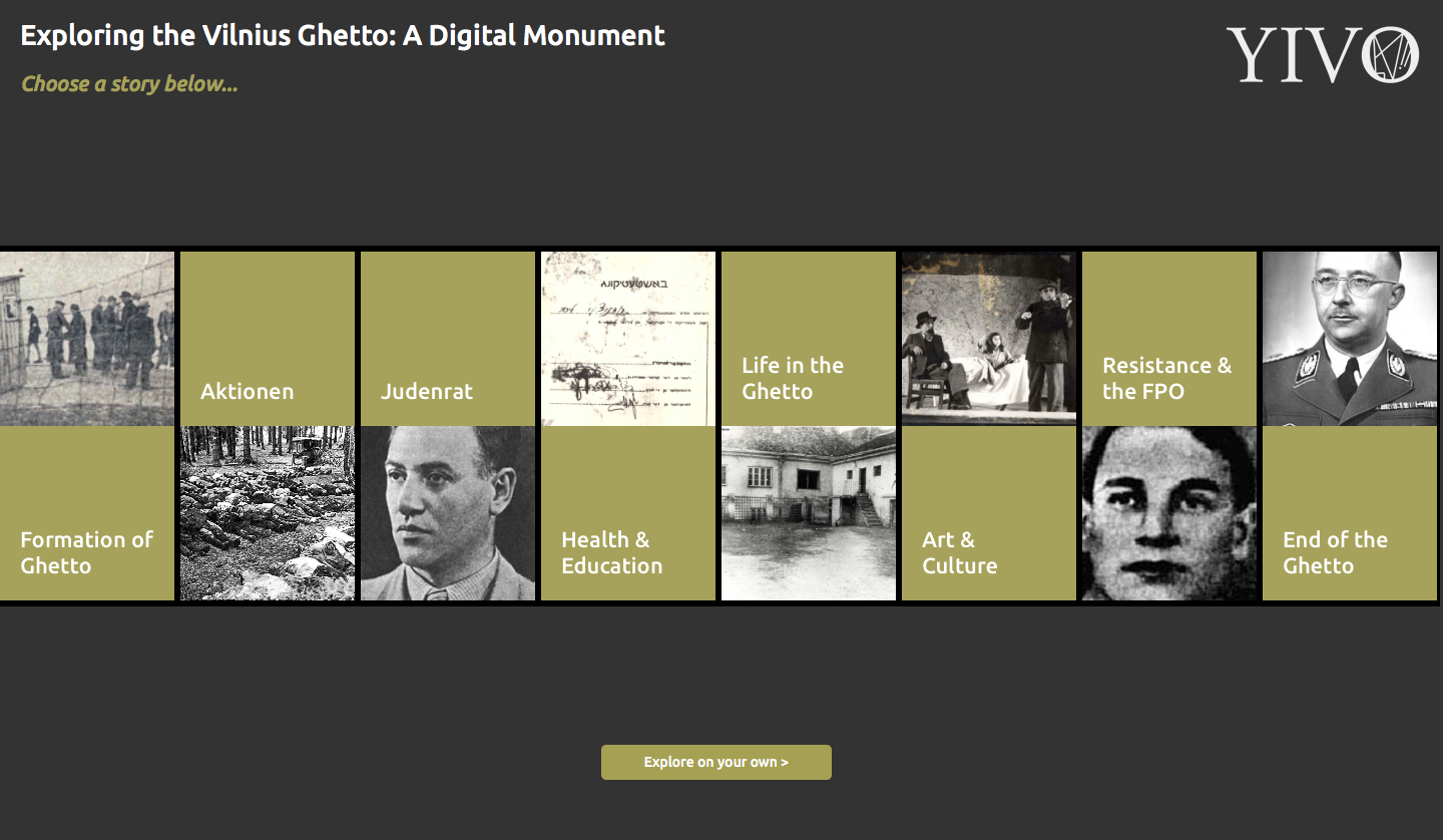
The map of the jewish Vilna Ghetto was created primarily from a historical perspective exploring the formation of the ghetto and the places and events that were important during its use. Before accessing the Map, you are encouraged to choose one of the storylines that has been curated by the creator of this map. As you can see from the screenshot below, there are eight different storylines that have been procured.
Having the introduction of the map be through curated storylines increases the user friendliness of the map but it also serves to make the experience more subjective and contrived. This map makes the assumption of the individual being interested in a historically contextual representation of the Vilna ghetto, rather than a clear visualization of the ghetto, and the geographically and visually contextualized relevance to an individual. The largest zoomed out representation of the map does not surpass the town limits, which makes it difficult for individuals exploring the map to place it contextually within their geographic understanding. This assumes that the subjective understanding of the events is more important to the narrator than a personally relevant and individually contextualizable understanding of the events.
This map was built to immortalize the experience of those who lived through the time in which this ghetto was formed and eventually torn down. The map obscures the context of the greater world war II or the city of Vilna as a whole. The map reveals the struggle, and semblance of normalcy that was retained by the members of the ghetto, with their art and culture, as well as their struggle to resist, but it is difficult to ascertain the importance of the Vilnius ghetto in the grand scheme of history.
I would have started with a map that shows exactly where Vilna is Globally located, and included all of the places and events of this time that is currently included in the map. I would have also created map locators for the descendants of those who lived in the ghetto, attempting to show the impact of this horrific camp on the individuals involved. I would have also included relocation details of the original inhabitants of the ghetto, to show the geographic location of the jewish population in the town as a whole, representing the inconvenience of relocating within your own city. It would also be interesting to show where reported kidnappings occurred throughout the course of this time period. The reason why I focused on the individuals in the camps versus their living experiences is that it would show the whole effect of the Vilnius ghetto, instead of a small sliver that was the life during this relatively short, if horrific, period of history.
I definitely agree on the fact that the project should give a broader scope of this piece of history. In addition, for someone who doesn’t have an idea of where Vilnius is, I agree that it is very beneficial to show where this ghetto is located.
Overall, I really think this map is visually appealing. I like that when you click on certain events/places, images show up with a small description of the point on the map.I do not necessarily agree that an alternative map with descendants would be adequate. I do think however, that the given map could be clearer to navigate. Also, I think it is difficult to understand the landscape of the map because the dots all look the same and are only distinguished from one another based upon color. This makes the map seem cluttered and difficult to interpret.